Hey guys,
I've taken my club to Fortune Creek and Tilkham so far this year. Some decent snow, but I'm looking for some information and directions to some better areas. I know people go to Green Mountain, Tonga Ridge, Quartz, etc. I'm looking for directions to reach all these areas and more. Thanks!
Looking for some help on places to take the club.
Re: Looking for some help on places to take the club.
Welcome to the forum! Once the snow level drops below 3000' a whole winter wonderland appears all around Western Washington and you can pretty much go anywhere there's an open road. The difficulty is when the snow level hasn't dropped. There are only a few places that get over 5,000'. I usually just stay home until the snow level drops. The last couple years have been rough. The Jacks Pass area is pretty good. Lots of side roads, and nice big play area once the snow level drops.
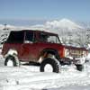
This is Jacks Pass.
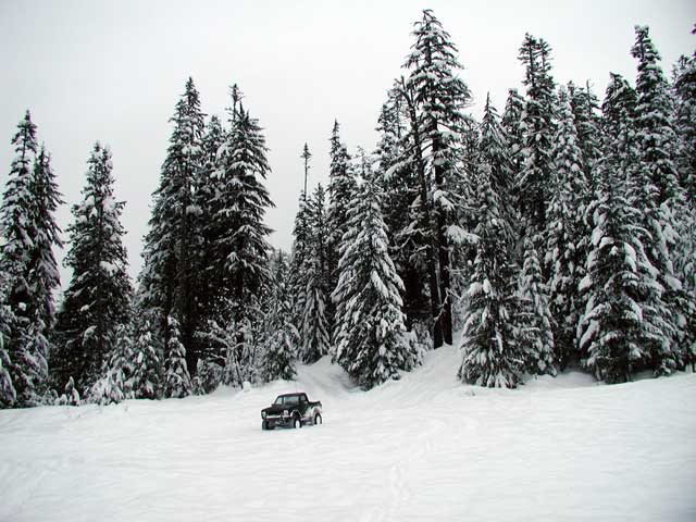
This is Jacks Pass.
WINTER IS HERE
Re: Looking for some help on places to take the club.
We don't mind going up high or a longer trip. Like i said its more about the specifics of the routes.
-
christensent
- Posts: 112
- Joined: Mon Dec 29, 2014 6:34 pm
- Location: Woodinville, WA
Re: Looking for some help on places to take the club.
I always just check snowfall telemetry (snotel and NWAC both have pretty extensive washington telemetry systems) to find what elevation recent snowfall started to accumulate at, locate a forest road that goes at least 1000ft above this elevation, check forest service website to ensure the road is not closed to wheeled vehicles, and avoid Tonga Ridge, Hyak, Denny Creek, and Tinkham unless it is the morning after a storm because they'll all be tracked out within hours (often the night of the storm itself).SqWADoosh wrote:We don't mind going up high or a longer trip. Like i said its more about the specifics of the routes.
If all the above conditions cannot be met, I don't go. Last year it was extremely hard to meet those conditions but this winter is doing much better!
Re: Looking for some help on places to take the club.
Where on their website are you finding a list of closed roads? All I can find is this: http://www.fs.usda.gov/detail/mbs/condi ... RDB5126323christensent wrote:I always just check snowfall telemetry (snotel and NWAC both have pretty extensive washington telemetry systems) to find what elevation recent snowfall started to accumulate at, locate a forest road that goes at least 1000ft above this elevation, check forest service website to ensure the road is not closed to wheeled vehicles, and avoid Tonga Ridge, Hyak, Denny Creek, and Tinkham unless it is the morning after a storm because they'll all be tracked out within hours (often the night of the storm itself).SqWADoosh wrote:We don't mind going up high or a longer trip. Like i said its more about the specifics of the routes.
If all the above conditions cannot be met, I don't go. Last year it was extremely hard to meet those conditions but this winter is doing much better!
Re: Looking for some help on places to take the club.
You have to drill down another level, then scroll below the map.SqWADoosh wrote:
Where on their website are you finding a list of closed roads? All I can find is this: http://www.fs.usda.gov/detail/mbs/condi ... RDB5126323
http://www.fs.usda.gov/detailfull/mbs/a ... width=full
WINTER IS HERE
Re: Looking for some help on places to take the club.
Excellent. Thanks!Nobody wrote:You have to drill down another level, then scroll below the map.SqWADoosh wrote:
Where on their website are you finding a list of closed roads? All I can find is this: http://www.fs.usda.gov/detail/mbs/condi ... RDB5126323
http://www.fs.usda.gov/detailfull/mbs/a ... width=full
Re: Looking for some help on places to take the club.
Another thing I like to do is use google earth on a PC to search for places to go. You can see the elevation wherever your mouse is. As christensent said above, find out the current snow level and make sure the road goes a good 1000' above that.
WINTER IS HERE